
Springs of Bregalnica - Untouched Maleshevija
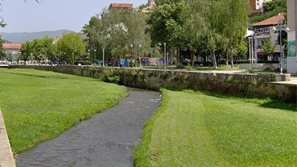
Bregalnica is the second longest river in the Republic of Macedonia. Hidden in a dense forest, at an altitude of 1200 meters, at the very heart of Maleshevo Mountains are the springs of Bregalnica. The trails to the untamable nine waterfalls are accessible to nature lovers. The river near Pehcevo continues to pass through or in the cities Berovo, Delcevo, Makedonska Kamenica, Vinica, Kocani and Stip, and then flows into the Vardar River before proceeding to the Aegean Sea. The Battle of Bregalnica took place in this area.
The Basin of Bregalnica
The basin of Bregalnica covers a territory of 4,307 km2, which is about 21% of the Vardar River basin and 17% of the entire territory of the country. On the eastern side it borders with Bulgaria, the area of the Strumica River to the south, the Pchinja River to the north and the river Vardar to the west. The average altitude of the Bregalnica Basin is 772 m. The Bregalnica area covers the territory of the entire East Planning Region. Geologically, the eastern part of Macedonia, including the Bregalnica basin, belongs to the Rodopic system (Serbian-Macedonian massif), consisting of crystallized shales and granites. The formation of these mountains occurred in Paleozoic, with disintegrations formed later in the Tertiary. Today, the basin is characterized by a diverse relief structure that contains plains, valleys, hilly and mountainous areas.
The total length of the river Bregalnica is 225 km, there are 6 tributaries on the left side and 6 tributaries on the right side. There are 6 large reservoirs on the river: Berovo / Ratevsko Lake, Kalimanci, Gratce, Zletovo Lake / Knezevo, Mantovo and Mavrovica.
Flora and Fauna along the basin of Bregalnica
The specific climatic conditions, as well as geological diversity in the region, create conditions for heterogeneous natural vegetation and differentiation according to the altitude. There are several plant communities in the region. The abundance of forests in the region is associated with the existence of 25 different tree species, with many other subspecies. Forests play an important role in water retention and erosion reduction, as well as in the maintenance of biodiversity. The total area with forests in the basin area is 1157 km2, or about 27% of the territory of the region. The region is characterized by a great variety of animal species, namely amphibians, reptiles, insects, birds and mammals. Birds and mammals form numerous associations, but many individual animals can be found from the lowest to the highest places. Fauna is particularly rich in forest landscapes.

Resources
The region is rich in mineral resources, including the important lead-zinc mines in Zletovo, Dobrevo and Makedonska Kamenica. Minerals of iron and titanium were found in the Osogovo massif. On the territory of Delchevo there are discovered deposits of gold, as well as alluvial gold in samples from the river Bregalnica. In the vicinity of Radovish is the big copper mine "Bucim".
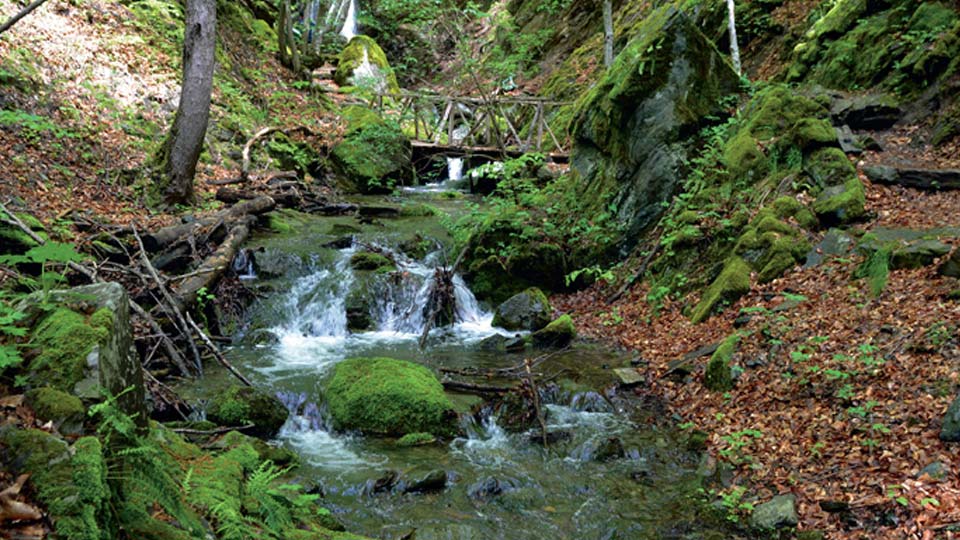
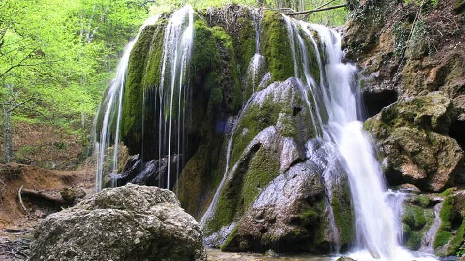
Pehchevo waterfalls on the river Bregalnica
A few kilometers from Pehchevo is the Ravna Reka tourist settlement, as well as the place Cengino Kale, also known as the easternmost point of Macedonia. The Bregalnica river flows from Chengino Kale, and below are the springs of two smaller rivers Lutachka and Zhtachka river, which in the place of Skokoto flow into another river that continues in Ravna Reka. This tourist site is abundant with lush vegetation, plains and waterfalls, known as Pehchevo Wateralls. The Pehchevo waterfalls, a total of four, are a place where you can draw natural force and they are a true art of nature, created along the river course.
More information about Bregalnica can be found on this website.
>